
A Geographic
Presentation of the Region (South West Region)
Before the name region, Cameroon first had provinces. The South
West Province was created in 1972 which is presently known as Region following
the presidential decree No 08/376 of 12th November
2008 organizing the administrative units in the Republic of Cameroon.
The south west region lies between latitudes 4o and
6o N of the Equator and longitude 8o and 10E of the prime
meridian. It is bounded on the west by the republic of Nigeria, on the north by
north west region of Cameroon, on the east by the eastern region and on the
west by the western and littoral (Douala) regions and on the south by the
Atlantic Ocean. Its close location to the Atlantic ocean, Nigeria, and the littoral
region is of strategic economic importance because the agricultural and natural
resources are within the reach of the Douala-base agro-industries and other
foreign markets.
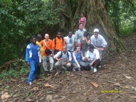 |
| The Forest Region of Mount Cameroon |
Relief
The south west has a varied landscape consisting of the
coastal lowlands, the Mamfe depression, and the rocky coast, the mount
Cameroon, Kupe Muaninguba and Rumpi Mountains. This landscape has a lot of
implications on the economic development of the region. The coastal lowland is
a vast sedimentary zone stretching from the mouth of river Akwa Yafe in the
extreme west to the mouth of river Lokoundje with an average altitude of 90m
interrupted to the east by the Cameroon Mountain. Close to the Atlantic Ocean
the coastal lowlands have mangrove swamps, several creeks, sandbars and sand
spits. These sedimentary deposits make navigation difficult and the
construction of good harbors an expensive venture.
 |
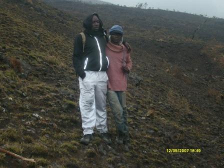
| Mount Cameroon Savanna |
|
|
 |
| The Rocky Region of Mount Cameroon |
The rocky coast lies between Bimbia and Idenau and results
from the extension of volcanic rocks from mount Cameroon that spread right down
into the sea. Past volcanic activities have also resulted to the presence of stacks
protruding above the sea and some metes off the coast of Limbe (Victoria). The
rocky coast is characterized by the presence of bays, capes, cliffs, and rocky
island making the area a potential zone for tourism and natural harbor
development.
The Mount Cameroon, Koupe Mounenguba and Rumpi mountains constitute
prominent volcanic peaks of the region. The Mt. Cameroon which is a heap of
piled up lava reaching a height of about 4095m is very immense with a length of
50k and a width of about 35km given it an area of some 1750km2. The
mountain is composed of different volcanic materials that in many places
accumulate to form small cones numbering about 75m. On some of the slopes of
the mountain we came across fumaroles that emit different gases and geysers
that send out water in gets. Thus, the mountain is a huge tourist attraction.
The Koupe Mountain with its culminating point reaching 2064m
overlooks the town of Loum and Tombel. It is built up mainly of crystalline
materials and then layers of volcanic flows with slopes that are almost vertical.
These materials are frequently been dug and used for road maintenance and for
building construction.
Climate
The south west region has experiences the
equatorial climate, particularly the Cameroonian type. It is generally very hot
and humid with two seasons; a short dry season of about four months and one wet
season of about eight months during which the rains are abundant throughout
with occasional thunderstorms that are destructive to vegetation and property.
The maritime Cameroon type is experienced along the sea-face
slopes of Mount Cameroon that receives the monsoon winds at right angle. This
area is well known as the second wettest place in the world (Debunscha)
recording an annual rainfall of about 10.000mm. On the whole, rainfall in this
region average more than 4000mm per annum. Further inland to the north of
Mount Cameroon rainfall is usually between 2000mm and 4000mm per annum.
The temperatures are very high throughout the year varying
from 20oC to 28oC. However, altitude exercise much
influences in lowering the temperatures of certain areas especially on mount
Cameroon and the Koupe Muanenguba Mountains.
Generally, high temperature, high rainfall, high relative
humidity and volcanic soil favor luxuriant vegetation growth and the breeding
of a wide variety of insects. To the peasant farmers such as conditions are
rather enervating and make agriculture an irksome and sapping task.
Surface Area
South West is one of the ten regions that make up the
Republic of Cameroon. It has an area of about 24.910km2 representing
5.2% of the surface area of the country. Mount Cameroon occupies about 1.750km2.
on the south east and west of mount Cameroon there are substantial area that
are covered by mangrove, swamps and particularly in Meme, there are large
expanses of land covered by forest containing a wide variety of plant and
animal species.
Vegetation
South West has a huge forest resource which if exploited in a
sustainable manner, can boast development. The region is located along the dens
equatorial forest region with two distinguished vegetation types – the mangrove
and the rain forest.
The mangrove forest occupies the two swampy regions of the
coast – the region around Rio-de-Rey and the Mungo basin. The mangrove swamps
around Rio-de-Rey extend from Akwa Yafe River in the West to the foot of Mount
Cameroon just east of Bamuso and inland as far as Isangele stretching down to
west coast. The other swamp region starts from Bimbia through Tiko to Mudeka
and down town to the whole of Douala basin. The trees here have developed very
long roots that plunge from the stem down into the swamps. This region is highly
infested with mosquitoes and other insects. The highly indented nature of the
makes navigation difficult.
The evergreen forest that lies inland just after the mangrove
forest has been subjected to human attacks for farms, lumbering and settlement.
Where these exploitation have taken place, a type of secondary forest does
appear.
The primary forest in its unhampered form can still be found
around the Korup area. Here the forest is immense, luxuriant, and has a
continuous canopy of leaves. This evergreen forest contains trees of economic
importance such as the iroko, mahogany, obech, ebony, padouka, tiama, framire,
sapelli, makore and bilinga. It is worth noting too that this forest is the
home of many animals such as chimpanzees, elephants, monkeys and many rodents.
Population Distribution of the South West Region
by Administrative Units and By Sex
Administrative Units
|
Total Population
|
Sex
|
Male Ratio
|
|
Male
|
Female
|
|||
SOUTH WEST REGION
|
1316079
|
666822
|
649257
|
102,71
|
FAKO
DIVISION
|
466412
|
234145
|
232267
|
100,81
|
Buea
|
131325
|
65714
|
65611
|
100116
|
West Coast
|
12725
|
6756
|
5969
|
113,18
|
Limbe
|
118210
|
57982
|
60228
|
96,27
|
Muyuka
|
86268
|
43989
|
42279
|
104,04
|
Tiko
|
117884
|
59704
|
58180
|
102,62
|
KUPE
MUANENGUBA DIVISION
|
105579
|
53509
|
52070
|
102,76
|
Bangem
|
21411
|
10589
|
10822
|
97,85
|
Nguti
|
27151
|
13694
|
13457
|
101,76
|
Tombel
|
57017
|
29226
|
27791
|
105,16
|
LEBILIAM
DIVISION
|
113736
|
56021
|
57715
|
97,06
|
Alou
|
35855
|
17659
|
18196
|
97,05
|
Fontem
|
39706
|
19453
|
20253
|
96,05
|
Wabane
|
38175
|
18909
|
19266
|
98,15
|
MANYU
|
181039
|
91135
|
89904
|
101,37
|
Akwaya
|
85914
|
42456
|
43458
|
97,69
|
Eyumudjock
|
35999
|
18470
|
17529
|
105,37
|
Mamfe
|
31641
|
16136
|
15505
|
104,07
|
Upper Sanyang
|
27485
|
14073
|
13412
|
104,93
|
MEME
DIVISION
|
326734
|
167554
|
159180
|
105,26
|
Kumba
|
166331
|
85222
|
81109
|
105,07
|
Konye
|
44711
|
22884
|
21827
|
104,84
|
Mbonge
|
115692
|
59448
|
56244
|
105,70
|
NDIAN
DIVISION
|
19230
|
10717
|
8513
|
110,90
|
Bamusso
|
19230
|
10717
|
8513
|
125,89
|
Ekondo-Titi
|
56503
|
29374
|
72129
|
108,28
|
Dikome Balue
|
13364
|
6532
|
6832
|
95,61
|
Idabato
|
3482
|
2031
|
1452
|
139,97
|
Isangele
|
3476
|
1881
|
1595
|
117,93
|
Kombo Abedimo
|
2146
|
1127
|
1019
|
110,60
|
Kombo Itindi
|
2958
|
1830
|
1128
|
162,23
|
Muno Emba
|
14385
|
7451
|
6934
|
107,46
|
Toko
|
7035
|
3515
|
3520
|
99,86
|
Source: BUCREP, 2005 GPHC
Administrative Organization
South West Region is divided into Six Divisions; Fako, Kupe-Muanenguba,
Lebialem, Manyu, Meme and Ndian. Buea, situated on the slopes of Mount
Cameroon, is the Regional Head-Quarter. The Divisions divided into
Sub-Divisions and Districts are under senior Divisional officers. Kumba and
Limbe are urban council areas while the Sub-divisions and districts are rural
council areas.
Administrative Units
Division
|
Headquarter
|
Sub-Division
|
FAKO
|
Limbe
|
Limbe I, Limbe II, Limbe III,
Tiko, Buea, Muyuka, West Coast.
|
Kupe-Muanenguba
|
Bangem
|
Bangem, Tombel, Nguti.
|
Lebialem
|
Menji
|
Fontem, Wabane, Alou.
|
Manyu
|
Mamfe
|
Mamfe, Akwaya, Eyumojock, Upper
Bayang.
|
Meme
|
Kumba
|
Kumba I, Kumba II, Kumba III,
Mbonge, Konye.
|
Ndian
|
Mundemba
|
Mundemba, Bamusso, Ekondo Titi,
Isangele, Kombo Abedimo, Kombo Itindi, Idabato, Dikome Balue, Toko.
|
Economy:
Primary Sector
A.
Agriculture
South West Region was always referred
to as “The Cradle of the Green
Revolution”. This was and still is because of its great agricultural
potentials resulting from the fertile soil and good climatic conditions. The
majority of the population of South West Region depends largely on food crop
production, which is the mainstay of the economy.
Major Crops
-
Perennial
Crops: Cocoa, coffee, oil palm coconuts,
citrus and rubber.
-
Food
and Vegetable Crops: Cassava, maize, Yams (Tuber), plantain, Cocoyam (tuber)
Beans, Egusi, Potatoes, tomatoes, Okra, Cabbage also known as Brassica oleracea. , Groundnuts, Pepper, carrots, Lettuce.
-
Fruits:
Mango, Guava, Banana, Pineapple and Plum.
-
Animals:
Fowls, Pigs,, Goats, Sheep, Cow, Horses, Rabbit, Dogs, Galago, Etc.
No comments:
Post a Comment